
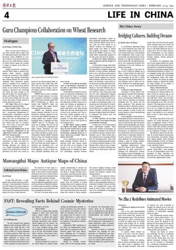


In 1973, three silk maps — a topographic map, a military map, and a prefecture map — were discovered in Tomb 3 in the Early Western Han tomb complex in Mawangdui, dated 168 BC. They are recognized as one of the earliest known Chinese maps at the time of their discovery.
The discovery of these maps is a milestone in the history of world cartography, as they provide valuable physical materials for the study of ancient China's geographic cognition, surveying and mapping technology, and military strategy.
The topographic map, over 2,000 years old, depicts the topography of southern China during the Western Han Dynasty, with fine lines and symbols, including mountains, rivers, roads, settlements, and other geographical information.
The area of the map covers an area roughly corresponding to present-day Hunan province, Guangdong province, and parts of Guangxi Zhuang autonomous region, showcasing ancient China's detailed geographical knowledge of the southern region.
Similar to modern contouring techniques, lines and symbols of varying thickness were used to represent the ups and downs of the terrain. Mountains are outlined with curves, rivers with double lines, roads with dotted lines, and settlements with circular or square symbols. This precise mapping technique shows that the geographers of the Western Han Dynasty had mastered complex map-making methods.
Moreover, these maps also demonstrate the systematic perception of geographical space in ancient China. In addition to natural geographic features, administrative divisions, military fortifications, and transportation routes were drawn in detail, laying a solid foundation for the development of cartography in later generations.